In the pitch-black night, a laser beam pierced the sky like a shining golden needle. "This is our 'atmospheric probe,' which can monitor the distribution of haze from the ground to an altitude of 10 kilometers in real time and analyze its composition," said Zhang Tianshu, an expert at the Environmental Optics Research Center of the Anhui Institute of Optics and Fine Mechanics, Chinese Academy of Sciences. This is a 'new weapon' for Chinese scientists in detecting air pollution — lidar.
These 'laser needles' are launched into the sky from plains, mountains, and seas, and they can also be mounted on vehicles and ships. Together, these 'laser needles' form a three-dimensional network, changing traditional detection methods, achieving vertical and comprehensive detection of near-surface air pollution without blind spots, and creating a three-dimensional 'roadmap' of pollutant dispersion to guide air pollution control.
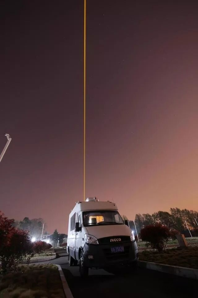
"The laser beam emitted by the lidar is like a 'probe' that can directly obtain observational data of atmospheric pollutants near the ground, such as PM2.5. Especially after networked observation, the data obtained by each 'probe' can also be analyzed using atmospheric physics and meteorological models, thereby dynamically and in real time understanding key information such as the temporal and spatial distribution, transmission channels, and total amounts of haze, establishing a three-dimensional simulation field of pollutants," said Zhang Tianshu.
This new type of lidar has currently accelerated its popularization, application, and networked observation in many densely populated regions such as Beijing-Tianjin-Hebei, the Yangtze River Delta, and Sichuan-Chongqing. The total number of units equipped nationwide is about 500, of which about 200 are in the Beijing-Tianjin-Hebei region, achieving full observational coverage.
Addressing the core scientific issues of the entire process of severe air pollution "occurrence-evolution-dissipation," lidar has enabled scientists to establish a three-dimensional observational network for atmospheric pollution transmission channels. In addition to the fixed-position 'laser probes,' there are also coordinated mobile and airborne observations during heavy pollution periods and processes, as well as ground-based remote sensing and satellite remote sensing observations.
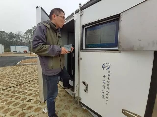
↑ Scientists are debugging the LiDAR. (Photo by Zhu Qing)
"In the coming years, controlling near-surface ozone, which causes smog and major secondary pollutants, will become a new focus and a breakthrough point for coordinated smog control. It is also an important environmental parameter that currently attracts global attention. LiDAR will make more contributions to real-time three-dimensional monitoring of near-surface ozone, thereby providing technical support for coordinated smog control," said Zhang Tianshu.
It is understood that in the future, LiDAR deployment will continue to increase in regions such as the Sichuan-Chongqing area and the Fenwei Plain to achieve full observation coverage. At the same time, detection technology will continue to develop across multiple platforms, including vehicle-mounted, airborne, and satellite-mounted systems, enabling the sharing of environmental protection, meteorological, and scientific research data. Scientists around the world can collaborate to jointly study and manage Earth's atmospheric pollution.
For more information, please contact us at austin@tianxiang-laser.com or 86-13761056165.